
The true dark history of Paris isn’t in the Catacombs; it’s hiding in plain sight, scarred into the city’s stones, and this guide teaches you how to read those secrets.
- Discover the exact, unmarked locations of the Revolution’s guillotines, not just the general area.
- Learn to trace the “ghosts” of Paris—from lost rivers to phantom-haunted palaces that no longer exist.
Recommendation: Use this guide not as a list, but as a lens to see a different, darker Paris on your next walk, turning you into the expert of your group.
Forget the postcards and the romantic clichés. The Paris you see is an urban palimpsest, a manuscript of stone and cobblestone where centuries of history are layered, one on top of the other. Most tourists walk through its grand squares and charming alleys, completely unaware of the bloody, bizarre, and tragic stories written right under their feet. While many seek out the obvious macabre sites like the Catacombs or Père Lachaise, the real thrill lies in finding the secrets that hide in plain sight.
This isn’t just a list of spooky places. This is a field guide for the urban historian, the curious traveler who wants to impress their friends with more than just a pretty picture of the Eiffel Tower. We’re going to peel back the layers of Haussmann’s elegant city to find the medieval chaos, revolutionary fervor, and battle scars that remain. You will learn not just *what* happened, but *how to find the evidence* for yourself. It’s time to stop being a tourist and start being a detective of history.
This journey will take us to the precise spot where kings fell, along the path of a river that has vanished, and into the footsteps of ghosts and freedom fighters. Follow along to uncover the clues embedded in the very fabric of Paris.
Summary: A Guide to Paris’s Hidden Scars
- Place de la Concorde: Where Exactly Did Louis XVI Die?
- The “Oldest House” Debate: Is it Rue François Miron or Rue Volta?
- Where to See the Ghost of the Tuileries Red Man?
- Why Is It Called “Rue du Chat-qui-Pêche”?
- The Bièvre River: Where Can You See the Lost River of Paris?
- Why the Crypt Archaeologique Is the Best Alternative to Entering the Cathedral?
- Bullet Holes: Where to See Traces of the Liberation Fighting?
- How to Create a “Time Travel” Itinerary for Kids in Paris Museums?
Place de la Concorde: Where Exactly Did Louis XVI Die?
The Place de la Concorde, with its magnificent obelisk and fountains, feels like the elegant heart of Paris. During the Revolution, however, it was the “Place de la Révolution,” the grand stage for the Terror’s most famous public spectacles. While it’s common knowledge that the guillotine stood here, most guides will vaguely wave a hand towards the center. The truth is more precise and chilling. During its time here, the “national razor” was moved. But for the execution of King Louis XVI on January 21, 1793, the location was specific and symbolic.
To find it, you must perform a bit of historical triangulation. Ignore the obelisk. Instead, walk to the northwest corner of the square, near the entrance to the Rue de Rivoli. Here you’ll find a large pedestal that once held the statue of the city of Brest. The original statue was melted down during WWII, but its stone base remains. Stand directly in front of this pedestal and face the center of the square. You are now standing on the exact spot where the scaffold for Louis XVI was erected. For later, more numerous executions—where over 1,119 out of 2,498 total executions in Paris took place—the guillotine was moved closer to the entrance of the Tuileries Garden.
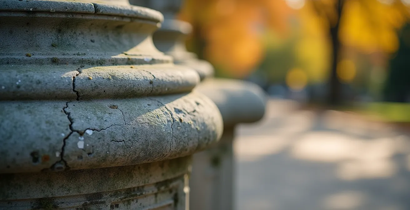
Take a moment to look at the worn stone of the pedestal. It’s an unassuming marker for such a world-changing event. From this vantage point, you can see the entire axis of power: the Assemblée Nationale across the river, the Tuileries Garden where the royal family was held, and the Champs-Élysées stretching into the distance. Standing here, you feel the weight of history far more intensely than if you were just snapping a photo of the obelisk.
The “Oldest House” Debate: Is it Rue François Miron or Rue Volta?
Parisian guidebooks love a good superlative, and the “oldest house in Paris” is a coveted title. For decades, that honor was given to a charming, half-timbered house at 3 Rue Volta in the Marais, with a sign proclaiming it was built in 1292. Tourists flock to it, imagining medieval life. But this is a case where history, and science, tells a more interesting story. The real detective work involves a bit of architectural forensics.
The house at 3 Rue Volta was, in fact, declassified as the oldest. Scientific analysis in the 1970s, specifically dendrochronology (tree-ring dating) on its timbers, revealed it was actually built in 1644. This makes it old, but not medieval. The true, undisputed oldest house in Paris is the home of Nicolas Flamel at 51 Rue de Montmorency, built in 1407. However, the most visually striking medieval-style houses are a pair at 11 and 13 Rue François Miron. With their exposed timber beams (colombages), narrow facades, and steep, irregular roofs, they scream “Middle Ages.” Even these are likely from the 16th century, heavily restored, but they provide the best visual clue to what pre-Haussmannian Paris looked like.
So how can you spot these architectural survivors? Look for key clues: exposed timber frames, upper floors that jut out over the street (corbelling), narrow building plots, and a chaotic arrangement of window sizes. These features stand in stark contrast to the uniform, stone-faced elegance of the buildings that replaced them. The Rue Volta story is a perfect lesson: in Paris, even long-held “facts” must be questioned, and the real story is often more complex and fascinating than the myth.
Where to See the Ghost of the Tuileries Red Man?
You can’t. The Tuileries Palace, the historic royal residence that stretched from the Louvre to the Place de la Concorde, is gone. And with it went the primary haunting ground of one of Paris’s most enduring phantoms: the “Homme Rouge des Tuileries,” or the Red Man of the Tuileries. But the story of this ghost and the palace’s demise is a powerful tale of political prophecy and urban transformation.
The legend of the Red Man is not a simple ghost story; it’s a political allegory. The phantom, said to be the spirit of a butcher named Jean who was murdered by order of Catherine de’ Medici, was a recurring omen of doom for France’s rulers. He reportedly appeared to foretell the death of Henri IV, the downfall of Louis XVI, and the defeats of Napoleon. His final legendary appearance was just before the Tuileries Palace was burned to the ground by the Paris Commune on May 23, 1871, during its final, bloody week. The palace’s destruction was an act of symbolic defiance against centuries of monarchy and empire.
After 1871, the Red Man was effectively “homeless,” his spectral appearances ceasing with the destruction of his home. Today, you can walk through the Jardin des Tuileries, the formal gardens that once lay before the palace. Stand near the Arc de Triomphe du Carrousel and look towards the Louvre’s main pyramid. Then, turn and face the Place de la Concorde. You are standing in the vast, empty space where the palace once stood. The ghost may be gone, but the ghost of the palace itself—its absence—defines the modern landscape of central Paris. The story of the Red Man became a metaphor for France’s own turbulent search for political stability in the late 19th century.
Why Is It Called “Rue du Chat-qui-Pêche”?
At just 1.80 meters (less than 6 feet) at its narrowest point, the Rue du Chat-qui-Pêche (the Street of the Fishing Cat) is famously the narrowest street in Paris. Its name conjures a whimsical image of a feline angler dipping its paw into the Seine. The reality, as is often the case in old Paris, is far grimmer and more interesting. The name is a direct link to the city’s medieval poverty and its now-vanished second river, the Bièvre.
The street was originally a direct alleyway leading from Rue de la Huchette down to the banks of the Seine. This is precisely where the Bièvre, a small tributary heavily polluted by the tanneries and dye-works upstream in the 5th arrondissement, used to flow into the main river. The term “fishing” in this context was likely a grim euphemism. The “cat” was not a literal animal but a slang term for the impoverished locals and scavengers who would “fish” in the toxic sludge of the Bièvre’s mouth, searching for anything of value—scraps of leather, lost items, or anything they could sell or eat.
Walking down this claustrophobic alley today, you can still feel the medieval city. Notice the lack of sidewalks and the way the overhanging upper floors seem to lean in, almost touching. This wasn’t just for space; it was a crude fire-prevention method developed after the great fires of the 17th century. The street’s charming name, therefore, is not a quaint fable but a dark piece of social history, a testament to the harsh realities of survival on the polluted riverbanks of pre-modern Paris. It’s a perfect example of how a seemingly innocent name can hide a much deeper, darker story.
The Bièvre River: Where Can You See the Lost River of Paris?
The Bièvre is the ghost river of Paris. Once a vital waterway that defined the landscape of the Left Bank, it became so polluted by the 19th century’s industries that the city decided to bury it. Starting in the late 1800s and finishing in 1912, the entire Parisian stretch of the river was channeled into the sewer system and paved over. But a river’s memory is hard to erase. By engaging in some ghost topography, you can still trace its path through the modern city.
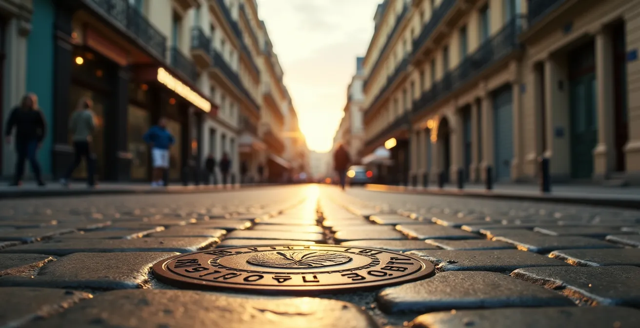
Your hunt begins in the 13th arrondissement. Start at Square René-Le Gall, a lovely park whose gentle, curving valley is no accident—it was built directly within the Bièvre’s former riverbed. From there, head to Rue Berbier-du-Mets. Look down. Embedded in the pavement are bronze medallions marking the path of the covered river beneath your feet. These markers are the most explicit clues to the river’s presence. Follow them towards Rue Croulebarbe, where you’ll notice a distinct and sudden dip in the street level; you are walking down into the river’s old valley.
For a more dramatic reveal, visit Parc Kellermann, further south near the city’s edge. Here, sections of the river’s original stone embankment walls have been excavated and left exposed, a tangible piece of the lost waterway. The very layout of streets like Rue de la Colonie or the shape of the Place d’Italie metro hub still follows the river’s ancient meanders. Tracing the Bièvre is a fascinating exercise in reading the landscape, proving that even when a feature is completely erased from the map, its ghost remains etched into the city’s form.
Why the Crypt Archaeologique Is the Best Alternative to Entering the Cathedral?
The fire that ravaged Notre-Dame Cathedral in April 2019 was a global tragedy, closing off access to one of the world’s most beloved landmarks. While the cathedral slowly undergoes its painstaking restoration, many visitors feel a void. However, right under the cathedral’s plaza lies an attraction that is not just an alternative, but arguably a more profound journey into the origins of Paris: the Crypte Archéologique de l’Île de la Cité.
The Crypt is not a religious site; it is a time capsule. It preserves the actual foundations of the city, layer by layer, going back long before the first stone of Notre-Dame was laid. As you descend below the plaza, you are literally walking back in time. The main attraction is the extensive remains of Lutetia, the Gallo-Roman city that was Paris’s ancestor. You can walk through the rooms of Roman houses, see the underfloor heating system (hypocaust) of the public baths, and stand on the original quay walls of the ancient port from the 1st century AD.
This is where the concept of the urban palimpsest becomes breathtakingly real. You can physically see how the island has grown, how the course of the Seine has shifted, and how successive generations built directly on top of the ruins of their predecessors. The visible foundations connect directly to the story of the Bièvre, showing where the tributary once defined the island’s settlement. While Notre-Dame represents 850 years of Gothic and French history, the Crypt takes you back 2,000 years to the very birth of Paris. Especially since the April 2019 fire, the Crypt has become the essential starting point for understanding the deep, layered history of the Île de la Cité.
Bullet Holes: Where to See Traces of the Liberation Fighting?
In August 1944, the streets of Paris became a battlefield. As Allied forces approached, the French Resistance rose up against the German occupiers, leading to a week of intense fighting for the city’s liberation. The physical evidence of that heroic struggle is still visible today, etched into the stone facades of central Paris in the form of bullet and shrapnel holes. These are the Scars of Liberation, and finding them is a poignant way to connect with one of the city’s proudest moments.
The most dramatic concentration of these scars can be found on the wall of the Préfecture de Police, across from Notre-Dame, and around the Place Saint-Michel. The fighting here was particularly fierce as Resistance fighters laid siege to the German-held police headquarters. You can easily distinguish the pockmarks from machine guns and the larger gouges from heavier ordnance. But the city’s decision to preserve this damage has not been without debate. As the Commission du Vieux Paris once pondered:
Are they a historical scar to be maintained as a duty of memory, or damage that should be repaired?
– Commission du Vieux Paris, Debate on preservation of Liberation bullet holes
For now, memory has won. You can embark on your own walking tour of these scars, turning a simple stroll into a powerful history lesson. By identifying these marks, you are bearing witness to the price of freedom and honoring the memory of the Parisians who fought to reclaim their city, street by street.
Your Liberation Scars Walking Route
- Start at the Préfecture de Police on Île de la Cité: Look for the heavily concentrated bullet impacts from the uprising of August 19, 1944.
- Walk to Place Saint-Michel: Find the scars on the base of the monumental fountain, remnants of fighting against German machine gun positions.
- Continue to Rue de la Huchette: In this narrow street, observe the different caliber holes from close-quarters street fighting.
- Visit the École des Mines (60 Boulevard Saint-Michel): Note the preserved facade damage, accompanied by a memorial plaque explaining its origin.
- End at Pont Neuf: Look for holes on the bridge’s stonework and try to distinguish the fresher 1944 damage from the more weathered scars of the 1871 Paris Commune.
Key Takeaways
- The most profound historical markers in Paris are often unmarked and require “historical triangulation” to locate.
- Learning “architectural forensics” helps you distinguish historical fact from myth by reading the clues in a building’s structure.
- Paris is a city of ghosts, not just of people, but of “ghost topography”—lost rivers and demolished palaces whose absence still shapes the modern city.
How to Create a “Time Travel” Itinerary for Kids in Paris Museums?
While this topic suggests an activity for children, a true history buff knows that the best way to understand a city is to create a narrative journey through it. By curating your own “time travel” itineraries, you can transform a series of museum visits into a compelling story. Instead of passively observing artifacts, you actively hunt for the clues that connect them. This is how you build an experience that you—and your friends—will never forget.
Let’s craft two such itineraries for the discerning historical detective, using Paris’s museums as our time machine. The goal is to follow a single story across multiple locations.
Itinerary 1: The Revolutionary Trail
Your mission is to follow the tragic final days of the French monarchy. Start at the Place de la Concorde, at the Brest statue pedestal where Louis XVI was executed. Then, proceed to the Musée Carnavalet, the museum of Paris history. Here, your targets are the collection of miniature guillotines, Marie Antoinette’s personal belongings from her imprisonment, and a letter written by Charlotte Corday before she assassinated Marat. End your journey at the Conciergerie, the grim prison where the queen spent her final days. Exploring the recreation of her cell after seeing her personal effects creates a powerful and haunting narrative arc.
Itinerary 2: Walking Through Roman Lutetia
This journey takes you back 2,000 years. Begin at the Crypte Archéologique to see the foundations of Roman houses and understand daily life. Next, visit the Arènes de Lutèce, one of the best-preserved Roman amphitheaters in Europe, hidden away in the 5th arrondissement. Unlike the Colosseum in Rome, you can walk on the arena floor and sit on the stone tiers, imagining the gladiatorial contests. Finish at the Thermes de Cluny (part of the Musée de Cluny – National Museum of the Middle Ages) to witness the staggering scale of the Roman public baths, with vaulted ceilings soaring 15 meters high. This itinerary makes the abstract idea of “Roman Paris” a tangible reality.
Now, equipped with the skills of historical triangulation and architectural forensics, it is time to step outside. Go and read the secret history written in the stones of Paris for yourself.